A Pilot's Guide to Inflight Icing
Module I - Before You Fly
Know the Situation
Section: Weather - Cloud Formations
Start This SectionCloud Formations Weather
For ice to form on an aircraft in flight, the air must be cold and contain moisture.
Icing conditions frequently occur when moist air is forced upward. As the air rises, it expands and cools. If the air cools to the saturation point (where the temperature equals the dew point), the moisture will condense into clouds or precipitation.
For ice to form there must be clouds or precipitation.
Icing can be most intense near the cloud tops, where the amount of liquid water is often greatest. Generally, this is the part of the cloud that has achieved the greatest amount of lifting, cooling, and condensation.

As air rises, it cools.
Cloud Formations Weather
The type of cloud formation can provide important cues to the stability of the air mass and the type and severity of the associated icing threat. For this purpose, clouds can be roughly categorized as:
Stratiform Clouds
Cumulus Clouds

Stratus cloud
Cumulus cloud
Cloud Formations Weather
Stratiform Clouds
Stratiform clouds develop into more-or-less uniform horizontal layers because they are produced by the lifting of layers of stable air. Stratiform clouds typically contain lower amounts of liquid water than cumulus clouds, but some stratiform clouds can contain high amounts of liquid water.
These clouds can have extensive coverage, and multiple layers can sometimes result in a total thickness traversing several thousands of feet. However, the vertical extent of an icing layer in a stratus cloud does not usually exceed 3,000 feet. Icing in stratiform clouds is usually found in the higher temperature mid- to low-level clouds below 15,000 AGL.

Stratus cloud icing threat
Cloud Formations Weather
Stratiform Clouds
Pilot Action Recommendation
IF: You encounter icing in stratiform clouds.
ACTION: Immediately activate the ice protection system if it is not already activated. Monitor the situation. Change your altitude by 3,000 feet.
CUES: Layered clouds with little vertical development; cloud description in area forecast.
WHY: Flight at a constant altitude in stratus clouds may result in prolonged exposure to icing conditions. A 3000 foot change in altitude will usually take you out of the icing environment, even if the aircraft remains in the clouds.

Change altitude to exit icing in stratus
Cloud Formations Weather
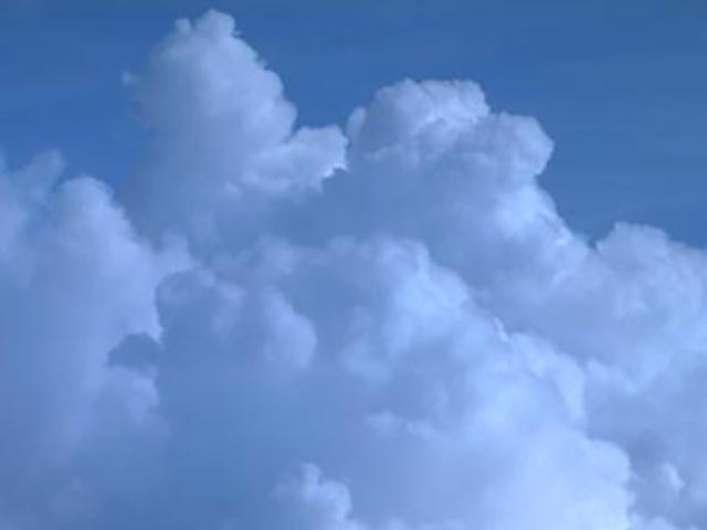
Cumulus Clouds
Cumulus clouds are formed when there is ample moisture and the air mass is unstable. The vertical extent of the cloud depends on the depth of the unstable air. Unlike stratus clouds, cumulus clouds usually have limited horizontal extent covering less of your flight route, but the vertical development can cause the range of icing to traverse many thousands of feet.

Cumulus cloud
Cloud Formations Weather
Cumulus Clouds
Icing encounters in cumulus clouds are usually short in duration but may be severe in intensity. They develop rapidly and often contain high amounts of liquid water and larger droplet sizes. Icing is most intense in the updrafts that have high liquid water content, which sometimes support SLD.
The horizontal extent of a single cumulus cell averages 2 to 6 nautical miles. However, the extent will be greater along convective cloud lines or clusters and in areas where convective clouds are embedded in stratiform clouds. Icing in cumulus clouds is usually found below 27,000 feet at temperatures between +2°C and -20°C.

Cumulus cloud icing threat
Cloud Formations Weather
Pilot Action Recommendation
IF: The temperature is between +2°C and -20°C and you can maintain visual separation from the clouds.
ACTION: Navigate laterally around cumulus clouds.
CUES: Cloud formations with extensive vertical development; cloud description in area forecast.
WHY: Icing encounters in cumulus clouds are usually short in duration but may be severe in intensity and present a substantial risk to safe flight.

Maneuver around clouds