A Pilot's Guide to Inflight Icing
Module II - In the Airplane
Icing Cues
Section: Environment
Start This SectionEnvironment Icing Cues
For ice to form on an aircraft in flight, the aircraft surface must collide with water droplets that remain liquid below the freezing point. Therefore, you can anticipate icing encounters and develop effective exit and avoidance strategies by paying close attention to:
Temperature
Clouds and Precipitation
To anticipate icing, watch the temperature and clouds
Environment Icing Cues
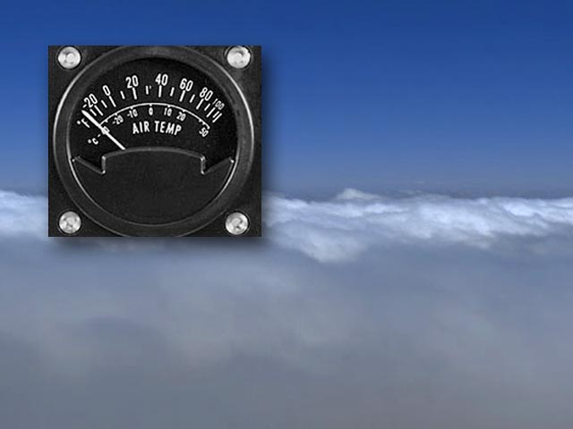
Temperature
Nearly all icing occurs at static air temperatures (SAT) between +2°C and -20°C. Icing may also occur when the SAT is above 0°C, if the aircraft surface temperature is below 0ºC. This might be due to recent flight at colder temperatures or slight temperature variations over the wing that can result from airflow accelerations. Below -20°C, icing is rare, though the only physical limit to icing is -40°C.
Monitor the outside air temperature. If you can climb or descend to altitudes with temperatures outside this range you will be able to avoid icing.
Compare the observed temperatures to the expected temperatures. Large discrepancies between the two may indicate an unexpected change in the weather, which may require changes in your ice avoidance and exit strategies.
Note: For aircraft with total air temperature (TAT) indicators, check the AFM for the appropriate TAT reference for icing.

Most icing occurs at static air temperatures (SAT) between +2°C and -20°C
Environment Icing Cues
Clouds and Precipitation
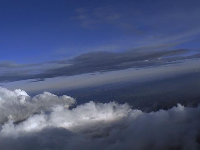
If the temperature is in the icing range and you can see clouds, the safest approach is to anticipate icing. However, for ice to form on an aircraft there must be liquid water. Moisture contained in a cloud in the form of vapor, snow, or ice generally will not accrete on an aircraft. If you can see the clouds before you penetrate them, you can use visual cues to help you judge the water content of the cloud and the associated icing potential.
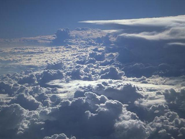
Visual cues to help anticipate the icing potential
Environment Icing Cues
Clouds and Precipitation
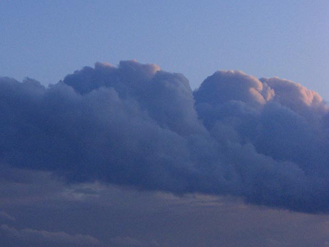
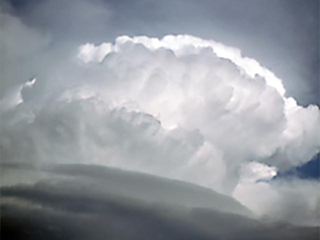
Development - Cumulus clouds that are building rapidly are more likely to have more liquid water.
Definition - If the edges of these clouds appear sharp and well defined, the cloud is likely to contain mostly liquid water. If the edges appear diffuse or fuzzy, the cloud is likely to be composed largely of frozen ice crystals. Ice crystals will not accrete on the aircraft.
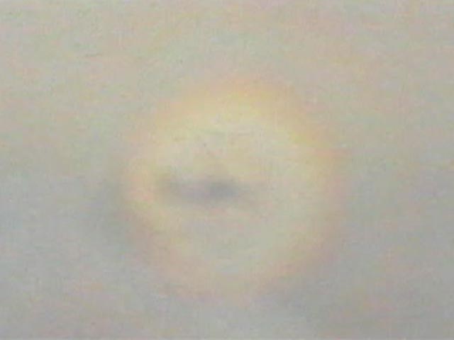
Color - If you are above a cloud deck and the sun is shining, look at the cloud deck about where the aircraft's shadow would be. If you see colored rings or a rainbow-like pattern (known as a glory), the cloud is likely to have liquid water.
Visual cues to help anticipate the icing potential
Related Information
Colored Ring
Environment Icing Cues
Clouds and Precipitation
Cloud formations can also be used to help you plan avoidance and exit strategies. Icing in cumulus clouds is usually limited laterally but can extend vertically for thousands of feet. Icing in stratus may be quite extensive laterally, but is usually less than 3000 feet thick vertically. To reduce the risk of entering potentially hazardous icing conditions in cumulus clouds, divert around building cumulus, and stay away from clouds associated with mountains. If necessary, minimize your exposure by choosing the shortest path through the cloud. In stratus clouds, stay above the cloud deck as long as practical and change altitude if you encounter serious icing.

Icing avoidance strategies
Environment Icing Cues
Clouds and Precipitation
Cloud formations can also be used to define the locations of fronts. Icing is often most intense in frontal conditions (see Frontal Effects section).
When in flight, compare your observations to the forecast. By monitoring the weather in flight, unexpected changes can be identified early enough to allow you to revise your icing exit and avoidance plans before the need becomes urgent.
Compare in-flight observations to the forecast